 |
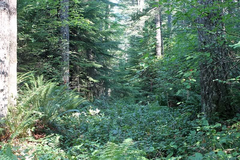
| Looking east, up the Clackamas River |
This was a trip originally put together by my friend Nick, whom I know from NAXJA. Somehow I basically ended up leading, go figure...
As was planned, we met at 9am in the Estacada Ranger Station parking lot and headed east. Oh wait, the two guys (Nick and Scott) who planned the trip rolled into Estacada 20 minutes late and still needed to stop at Subway to get lunch.
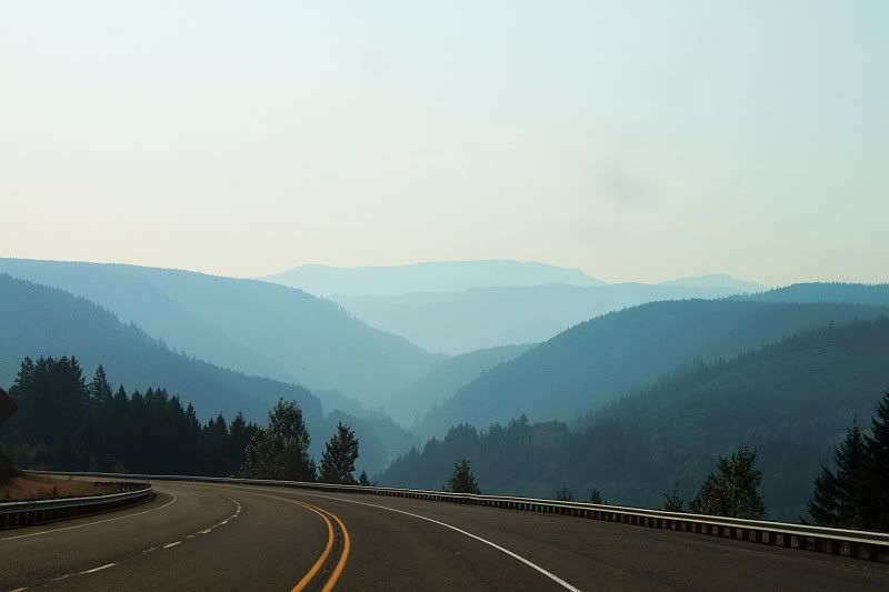
Around 9:40 we (Nick & Scott, Aaron, Jonathon & Mary, myself and 2 Jeeps from Grand Krawlers, Mike and Chaz) finally rolled out of Estacada, heading east on hwy 224 to the 4610 road, getting our first look at the smokey mountains in front of us.
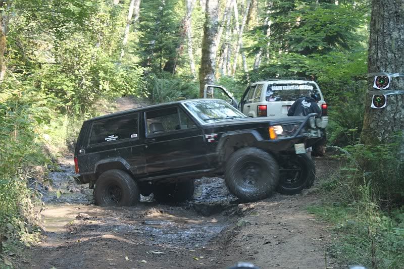
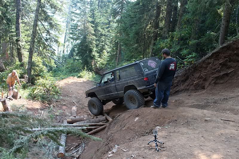
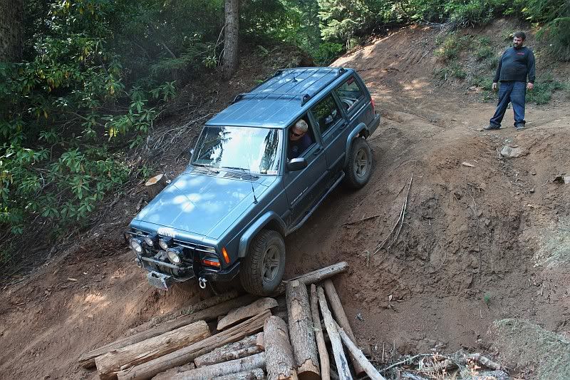
Our goal was to run the La Dee Flats OHV trails, before following 4610 east to Timothy Lake. The first trail section we got to would be part of the 800 trail. After Nick drove past it, I turned down the trail and lead the way. The trail was somewhat interesting though basically just an underused forest road that dropped down about 600 feet in less than a mile to the North Fork of the Clackamas River. The "trail" turned upstream for a few hundred yards and promptly ended in 2 guys' campsite, so we all go to find the side spot to turn around to head back up...
 |
| Aaron turning around in a muddy hole |
Once we got back to the top, we started looking for another section of trail. After noticing a lack of trails where the map showed there to be trails, we turned down a logging road that the map showed as a trail. It of course ended at a couple of small campsites. Then we tried another one and it went quite a ways then lo and behold, what appeared to be a new trail cut through the brush. We started following that back toward the 4610 road when it ended VERY abruptly. There were orange markers along the trail and they continued into the woods. We followed them on foot for a ways but it was obvious this was not an open trail yet.
After getting everybody turned around and bashing up my pass side rear shock on a chinese fingertrap of a rock, we once again returned to the 4610 road, where we determined we'd exhausted all the possible trails. There weren't any... Even though the map says there are established trails, there clearly aren't. A little frustrating as that was at least 40% of the reason we were up there. The map also showed a quarry/play area further up the road so we headed for that.
 |
| Some day, there will be a trail here |
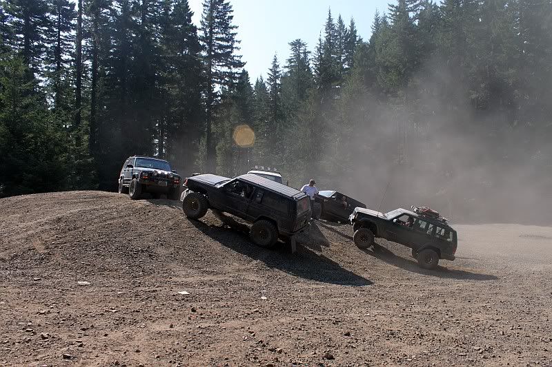
After quickly tiring of driving around on a pile of gravel, we regrouped and started toward Squaw Mountain, a short 2 mile spur off the 4610 to the top of Squaw Mountain. I stopped at the turn-off to wait for everybody to catch up. Nick, Aaron and Jonathon all showed up and we waited, and waited. AND waited... After waiting at least 20 minutes for Mike and Chaz to join us, I drove the 5 miles back down to the quarry where we had last been a group. They weren't there. I tried again raising them on the CB but nothing. I regretfully drove back up to the group waiting and we decided to move on, skipping the drive up to Squaw Mountain (turns out we wouldn't have seen anything anyway due to smoke)
BTW, Chaz was apparently having overheating problems so they turned around. One of the biggest no-no's in 4wheeling/exploring is you stick with the group. If you're going to leave, you have to tell the rest. We had no idea what had happened to them, they just disappeared. NOT ACCEPTABLE. If it were up to me, they would never be allowed on a run ever again. I certainly won't be responsible for them again.
 |
| Group pose on a small rock pile |
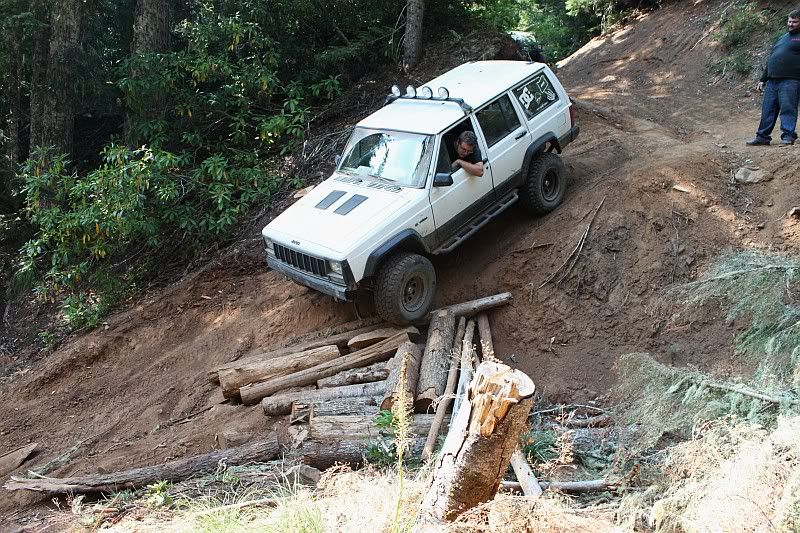
Anyway, we continued on the 4610 road east until we came to the famous washout. approx 200 feet of hillside slid down at least 20 feet, forcing a hard dropping right turn in the road, with a crevasse on the left side that you have to drop into. After standing around and looking at the road for 20+ minutes then the slowest airing down of a set of tires EVER, we determined the best action would be for Nick to hook his winch to the back rear of whoever was going down, to keep their rear-end from passing over the front.
Aaron went first and unfortunately, I didn't get any pictures of that, just video, which will come later. he made it look nice and easy to Jonathon went next. How was he feeling?
He made it look even easier than Aaron did!
After that, it was my turn, after lifting a tire before even turning down toward the drop, it was an easy trip down the hill for me (thanks Aaron for taking my camera)
The original plan was for Nick to turn around and lower himself down backwards, using the winch. However, once it was go time, he decided to just go for it. Turned out to be fine...
I think most of it was Scott's golden touch.
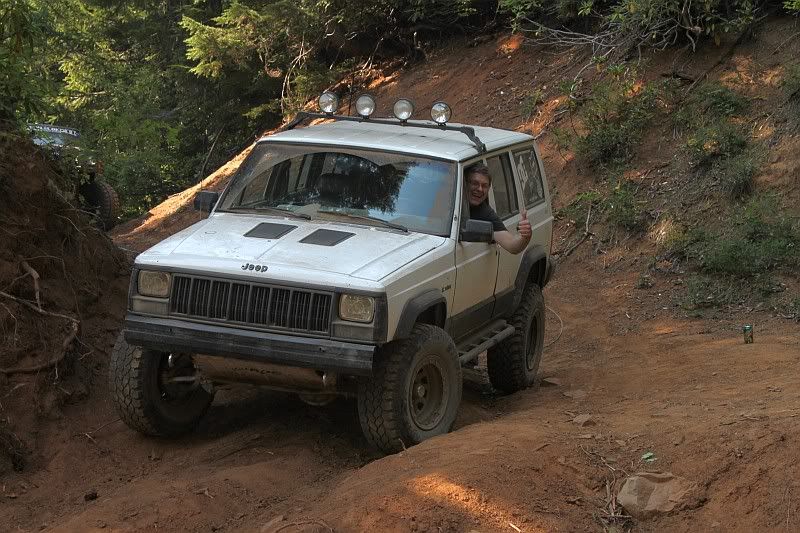 |
| Jonathon feeling confident |
 |
| Jonathon getting eased down by Nick's winch |
 |
| Nick making it look easy |
 |
| My turn! Thanks to Aaron Barnes for taking the picture |
 |
| Scott's golden touch |
 |
| Old rock slide location |
 |
| Finally, the end of 4610! |
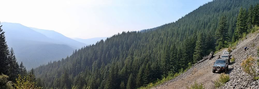
From there on, the road was basically level as it continued east, mostly running through woods, though occasionally popping out for a bit of a view.
Finally, we popped out onto pavement, quite a victory for me as the road has been on my checklist for 3 or 4 years.
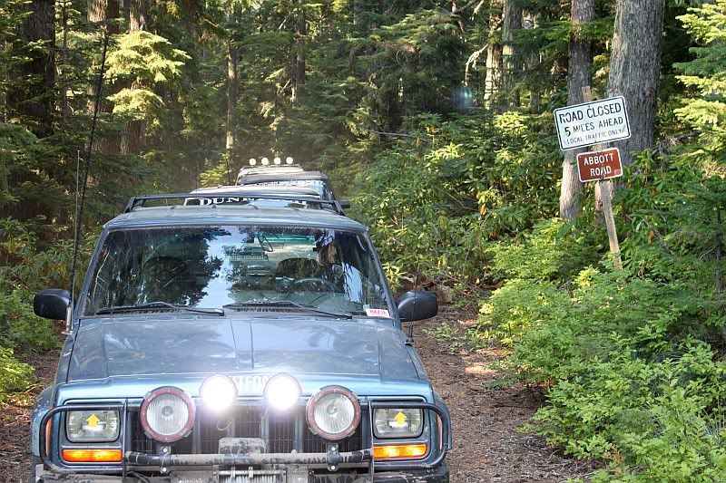
For the record, there are no road closed signs when you come from the west. Also, the USFS lists the road as open.
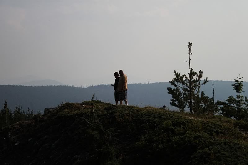
We then drove up to High Rock, though first dropping Aaron's Jeep off at the bottom.
 |
| Aaron and Jonathon |
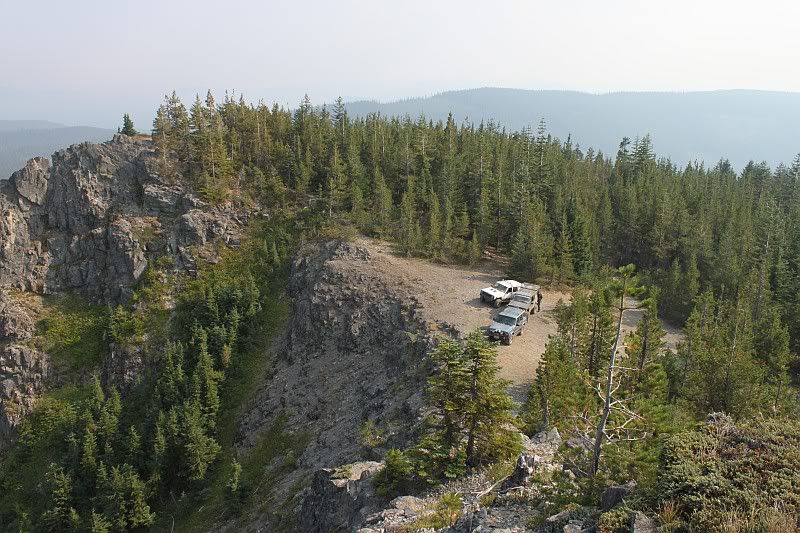 |
| The Jeeps below the top |
We had earlier discussed driving down to Detroit via Olallie Lake. First, we now had to make a trip out to CJ's Chevron on highway 26 so we could put gas in a certain black 2-door XJ. I won't name names... Once we all got a little gas (though I think only Aaron *needed* it. Oops) We started talking about timing. Nick & Scott, Aaron and Jonathon & Mary decided they were ready to go home, while I wanted to go down to Detroit to check out the fires around there.
 |
| |
I grabbed some snacks and bid farewell to the group and headed east on hwy 26 to the Skyline road. My plan was to drive down that then turn off and pass Olallie Lake and go over the hill to Breitenbush Lake before following the Breitenbush River out to Detroit, then over through the Opal Creek area and out along the North Fork Santiam then back to I-5. However, as I was heading down, radio traffic indicated there was a new fire by Bagby Hot Springs and that law enforcement was gathering to evacuate campers. I made the decision to go straight down to the 46 road, which follows the Clackamas River from the end of highway 224, then head up to Bagby Hot Springs to try and get some press-worthy pictures of evacuations.
Light was going to crap by the time I got in the area so I just grabbed a few other pictures and headed for home.
I came back into Estacada a little after 7. 10 hours and 157 miles after leaving Estacada.
Thanks to Nick, Scott, Aaron, Jonathon and Mary for helping me finally accomplish a trip that has been on my list for a long time. Now, it is time to pick the next trip to take and when...