
 So for Labor Day weekend, we decided to head down to the Christmas Valley area, south of Bend.
Christmas Valley is a fairly remote part of the state, often referred to as Oregon's Outback. Since I had never visited the area before, I relied heavily on the Internet and maps to plan out trip.
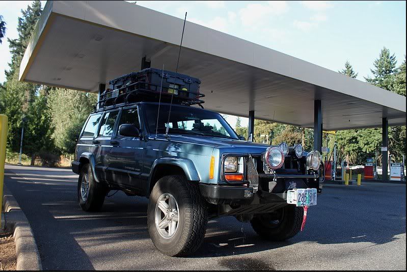
We headed out Friday afternoon after work, meaning we'd have to make our way out of town through traffic. Fortunately, I know enough backroads that I was able to avoid most of it. We made a few quick stops for air in Wilsonville then gas and food later but other than that, it was just a lot of driving.
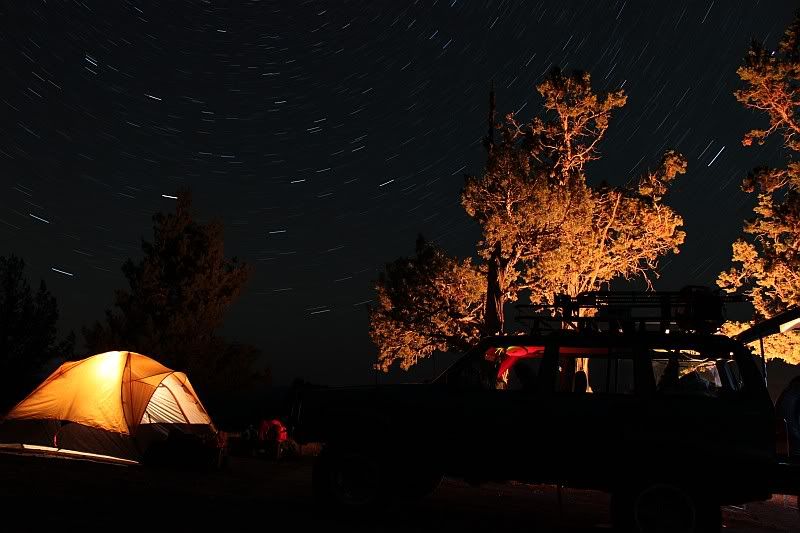 Since we didn't leave until 5pm on Friday, it was almost midnight by the time we finally got into camp at Green Mountain. Green Mountain is my new favorite place to camp, It is very small, four sites, with no water and just a pit toilet there. A few people were concerned that we wouldn't be able to get a site showing up super late on Friday of Labor Day. That was definitely no worry for us though, when we arrived, there was only one site occupied. We got camp set up and a little fire going then headed for bed.
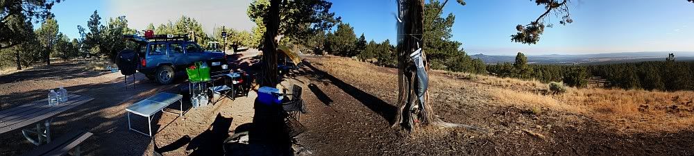 Saturday morning we awoke with the neighbors diesel pickup and the howling of coyotes about 7am and slowly got our day going. I cooked up some pop tarts and hot drinks while we let the day get caught up to us.
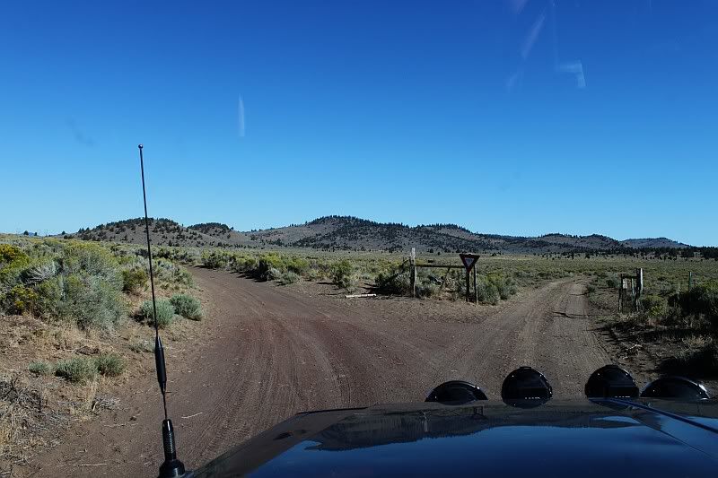 Our first stop for the day was Derrick Cave, an old lava tube an hour or so North of Green Mountain. On our way, we passed through an intersection with a yield sign, though I'm not sure who was supposed to be yielding to what, or if two cars had ever met at the intersection before.
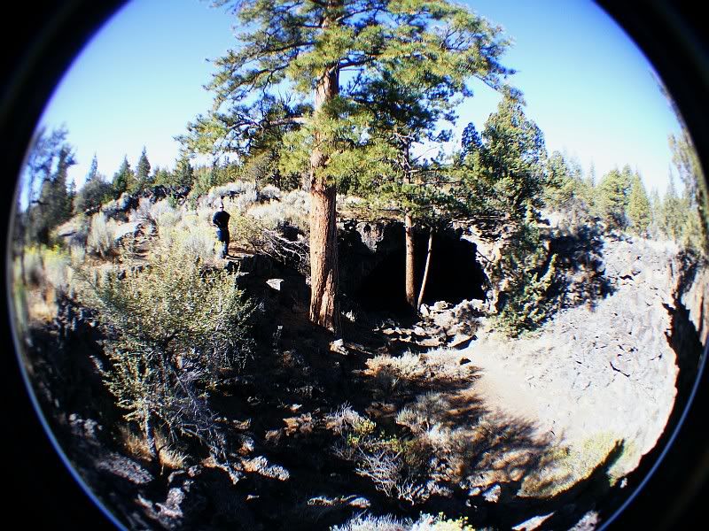
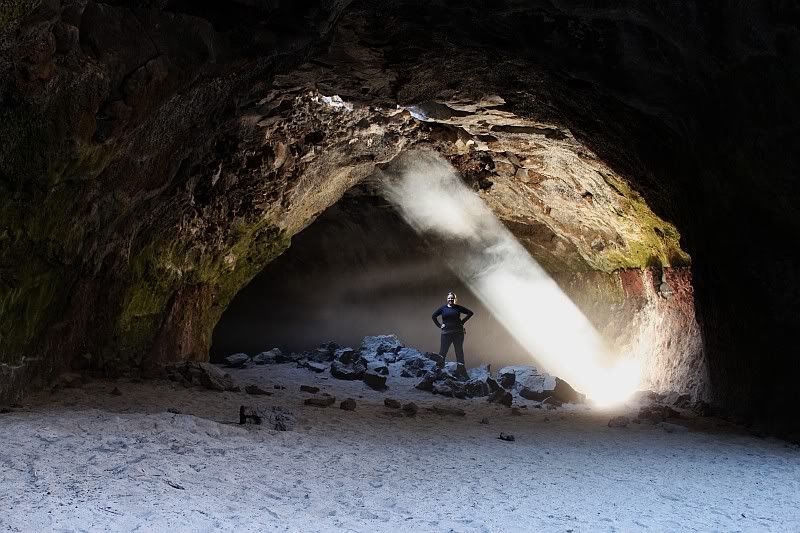
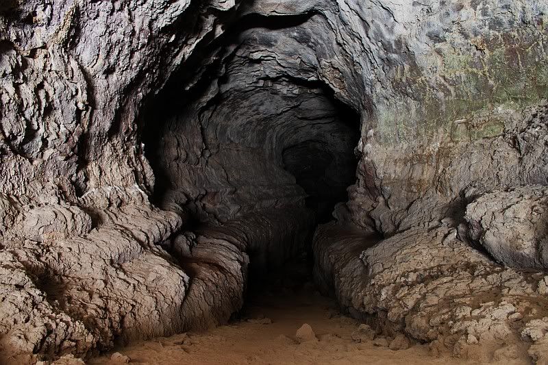
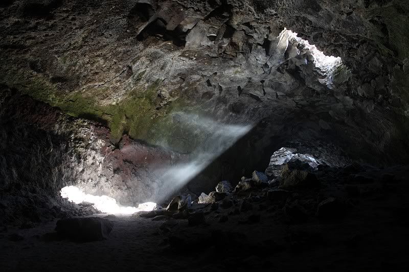
Derrick Cave is one of the coolest lava tubes I've ever been to. Access is made through one of several places where the roof has fallen through. There was a short section that went off to our right but the loose rocks made it seem rather unstable so we headed the other direction.
One of the collapsed spots created a beam of light that shown through, lighting up the dust in the air. We followed the tube for a short distance but as it started to go deeper and deeper, we decided to turn around and head back to the surface.
-
On our way back to the main road, we stopped at a couple of small cinder cones we'd noticed on our way in. I later found these were called The Blowouts but there was very little information I could find about how they were created other than they are volcanic cones.

After a brief hike up inside, we continued on down the road to Fort Rock. Fort Rock is essentially an old volcano which was eroded by and ancient lake that is thought to have once covered nearly 900 square miles of Central Oregon.

You can actually hike all the way through the rock area but we still had lots of places to visit for the day so we continued on.
Our next stop was Hole in the Ground, a large maar, or explosion crater. I've seen a number of pictures of it before, like the one below from Flickr user Justin Stranzl so I knew that there was a road to the bottom. My goal, find that road...


So off we headed and thanks to my GPS, I was able to pick the right road almost immediately. Down at the bottom, the view was pretty incredible as the ridge circled us as high as 700 feet above the center of the hole.

After a couple pictures and a refill of our water bottles, we turned around and headed back up. Nicole wasn't terribly fond of the road coming down as it had several off-camber sections that tilted the Jeep down hill with very little room for error. I offered to let her walk those sections and take some pictures, which she accepted as a good alternative. I slowly wove my way around the rocks and made it up the hill, no problem. I probably won't be taking that road in the future however...


Next up, we headed for Big Hole in the Ground, which is even bigger but is filled with trees, making it not so easy to recognize the size. We tried finding a geocache over there but had no luck. The GC location was near a set of cliffs, giving us our only real clue that we weren't just on a hillside.

Now our plans for later in the day included dinner in Silver Lake at 7pm so we still had several hours to kill. I had another Geocache saved in my gps atop a volcanic plateau called Table Rock so off we headed. My gps lead me in the wrong way but I was able to figure it out by coming all the way around the rock. The road up was pretty rough and I was glad to have 4-low to get up top. It was kinda breezy up top but not too bad. We decided that the view up there was great so I set the camera up on the tripod to take our picture.

I decided to shoot another and that is when disaster happened. As I stepped away from the camera, a gust of wind came up and before I could reach the camera, it felt face forward onto its lens, destroying the polarizing filter and my 18-55mm ef-s lens. Oops. The time ran out just as I was discovering the broken parts :(

Even with the disaster, I was still able to shoot some more pictures with my 55-250 lens and my old Fuji.


On the way up I was concentrating on keeping my Jeep moving forward on the steep road so headed back down I was able to stop breifly and take a picture.

We still had time to kill so we headed south-east on OR-31 toward Summer Lake, noticing several things along the way including a nice view of Table Rock, a little sign modification and a Peregrine Falcon.


After refueling in Summer Lake, we headed for Silver Lake, more specifically The Cowboy Dinner Tree, a restaurant south of "town" that is famous for their large, delicious portions and good prices. Your options are either a 26-30oz top sirloin or a whole roasted chicken, which they spend all day cooking. The food was amazing and there was enough for us to eat dinner for two whole days.

The next morning, we headed up to the lookout tower on the north summit of Green Mountain to check out the views and chat with the lookout for a while. He was a nice guy and he shared with us the plans (and what he thought of them) to replace the current cabin on the mountain with a new cabin atop a 50 foot tower with sepearate housing quarters for the lookout. I think the new tower will greatly improve the lookout's ability to view the surrounding area, specifically toward the south, which is currently blocked by the south summit.

Then Nicole and I headed for another amazing place, Crack-in-the-Ground, which is just a few miles south of Green Mountain. It is an incredible volcanic fissure over two miles long and, in places, over 100 feet deep. Truely an amazing place. We walked through a little less than half of it before heading back for the car and lunch and I cannot wait to get back and explore the rest.


On this trip I was trying out a new camping tool, a REI Camp Kitchen, which I picked up at REI's Labor Day sale, just days before out trip. I was very impressed with how quick and easy it was to set up. Maybe three minutes and I had a place for my stove, with the lantern overhead, storage for all our dishes and a few other table tops for random stuff that ends up around camp. I'm glad I picked it up though I was disappointed to discover that the windscreen for the stove was too small for my stove but at least my stove has a windscreen already built in. Overall I like it, though it is a bit much for a one night campsite if I'm leaving early in the morning.

Monday was our day for heading home. But of course I couldn't just go straight home, first we headed into Fort Rock then turned north on what becomes China Hat rd. We stopped breifly at South Ice Cave but it doesn't go very far so we kept moving pretty quickly. I scouted out a map on my Deschutes NF map and we zigzagged our way north, eventually coming in the back/east side of Newberry Crater. We stopped and had lunch at Paulina Lake campground before heading up Paulina peak. The views up there are absolutely incredible, one of the best views in Oregon as you can easily see ten Cascade peaks on a somewhat clear day. We also had a decent view of people out enjoying one of the last summer days on Paulina Lake.


Then we headed down the quick way and started north on US-97. That is when things quickly went sour. While shifting from 3rd to 4th, 4th gear blew up, fortunately I was able to get the transmission back into 3rd and we continued, amazingling, in 3rd all the way into and threw Bend, through and approximately ten miles west of Sisters before we got pulled over by an OSP Trooper who though I was going to slow, though I was not impeding traffic in any way. Since I was now stopped, I could not get my Jeep going again since I was stuck in 3rd so I called AAA for a tow and we rode the rest of the way home in the tow truck. Not fun...

What a fantastic trip and an amazing area. I cannot wait to get back out there next year to do more exploring.